As a Google Chrome user (alternating with Firefox depending on usage scenario: I’m a multi-browser person) and satellite imagery person, I’ve been enjoying a browser plug-in called Earth View, which customises every new tab with an image out of Google’s collection of particularly spectacular satellite imagery. These images are drawn from the DigitalGlobe and Astrium/CNES imagery that Google acquired for use in Google Earth and Google Maps. DigitalGlobes launched and runs the IKONOS, GeoEye and WorldView series of commercial satellites, and Astrium (or their parent company) operates the SPOT and Pleïades and other satellite platforms for the French and European space agencies. This is high-resolution optical imagery on a scale of 50 cm to 2.5m.
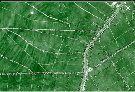
But even if you don’t use Chrome, you can still enjoy the images! Google recently launched an improved web site where you can browse, gallery-style, and share images with a direct link or on some social media platforms. There is also one-click access to the location on Google Maps and the option to download. Obviously, you just get a processed RGB JPEG at less than full resolution (and not a geo-referenced multi-band reflectance dataset which is available from the original sources for purchase), but still, the images are a lovely option to explore landscapes and urban structure. I’m learning a lot about serendipitous places of the world. Here’s an agriculture in Vietnam, for example. Click on the map and zoom in for a view of houses and roads along canals:
Or click on the hidden arrow to the right to find other places, such as in the US, Egypt, or Spain.
