Like many, I’ve been following the developing story of the large spill of mine tailings and water following the failure of a tailings pond dam at Indurstrial Metal’s Mount Polley mine near Likely, British Columbia, Canada. There has been much impressive video, but I haven’t seen a good map of the lay of the land. So I made a quick one from Landsat imagery.
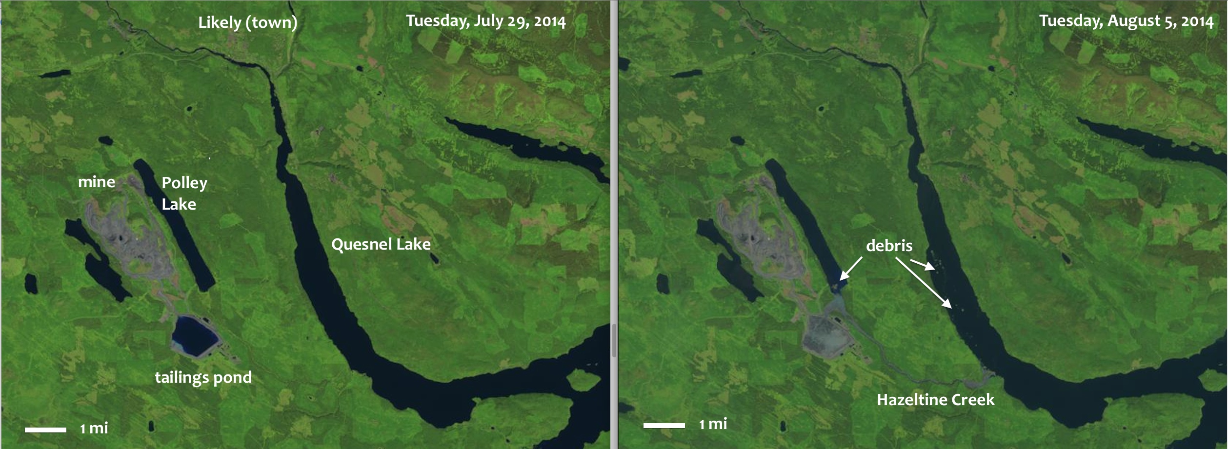
The before/after comparison shows the same location on the Tuesday before the spill (which happened on Monday, Aug. 4, 2014), and a week later. Debris, which after a day has not yet reached the town of Likely towards which it was headed, is visible in Quesnel Lake (and Polley Lake). Hazeltine Creek, which must have been a small stream passing close to the pond before the breach, is widened and filled with muddy water on a length of several miles (recognizable by the lighter colour). From the numbers I’ve seen, the volume of water:sediments in the spill was about 2:1, so we’re talking about liquid mud. I put in the 1 mi scale by eyeballing it — it’s not precise, but Polley Lake appears to be about 3 miles long.
These images are made from Landsat 8 scenes, which are available freely (simple registration requrired) from USGS (http://earthexplorer.usgs.gov). I did not process them myself, but took the shortcut and downloaded the pre-processed “LandsatLook” images, which USGS provides for illustration purposes (rather than science and image processing). These are JPG files of about 10 MB, which aren’t at full resolution. If I processed the file from the original scene, it would look better, but I didn’t want to download 2 GB of full-scene data and take about an hour to process it myself last night.
